Carlsbad Poinsettia fire 2014 aerial images
 May 24, 2014
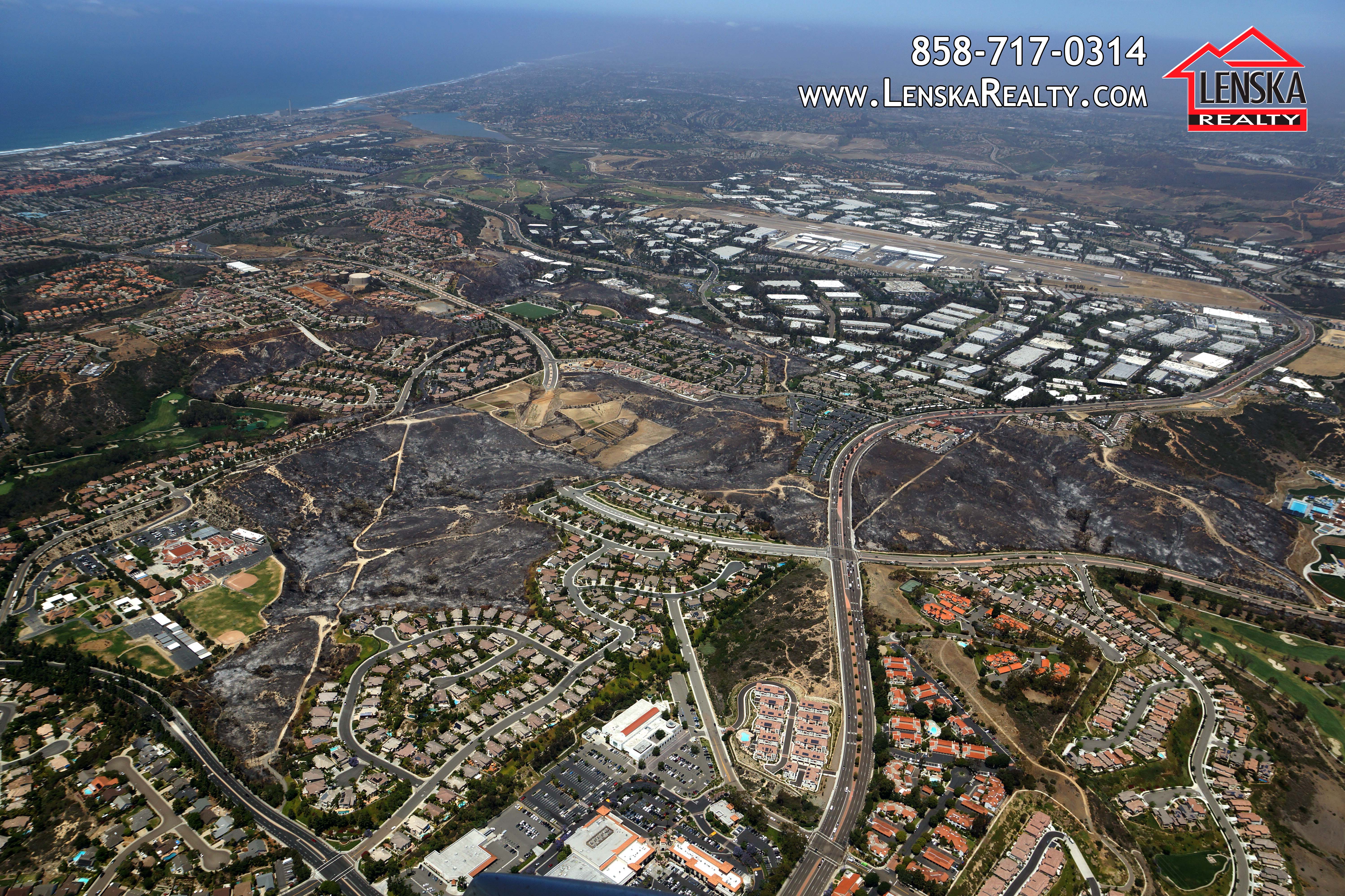
As a licensed pilot for over 20 years I have flown over the Palomar Airport business parks, Aviara Golf Course and the many expensive homes many times. The birds-eye view is telling a story, a very sad and sobering story. Check out the aerials below, zoom into each house and notice that the Carlsbad Poinsettia fire crept up to numerous back yards, charring palm trees, only torching so few back yards. Millions of thanks to our firemen and woman who did an outstanding job protecting expensive homes and properties. Home values range from $500,000 to over $1 million and with a median price of $750,000.
You are welcome to download these images for free and share them with your friends – click on the image to open it in full size and download.
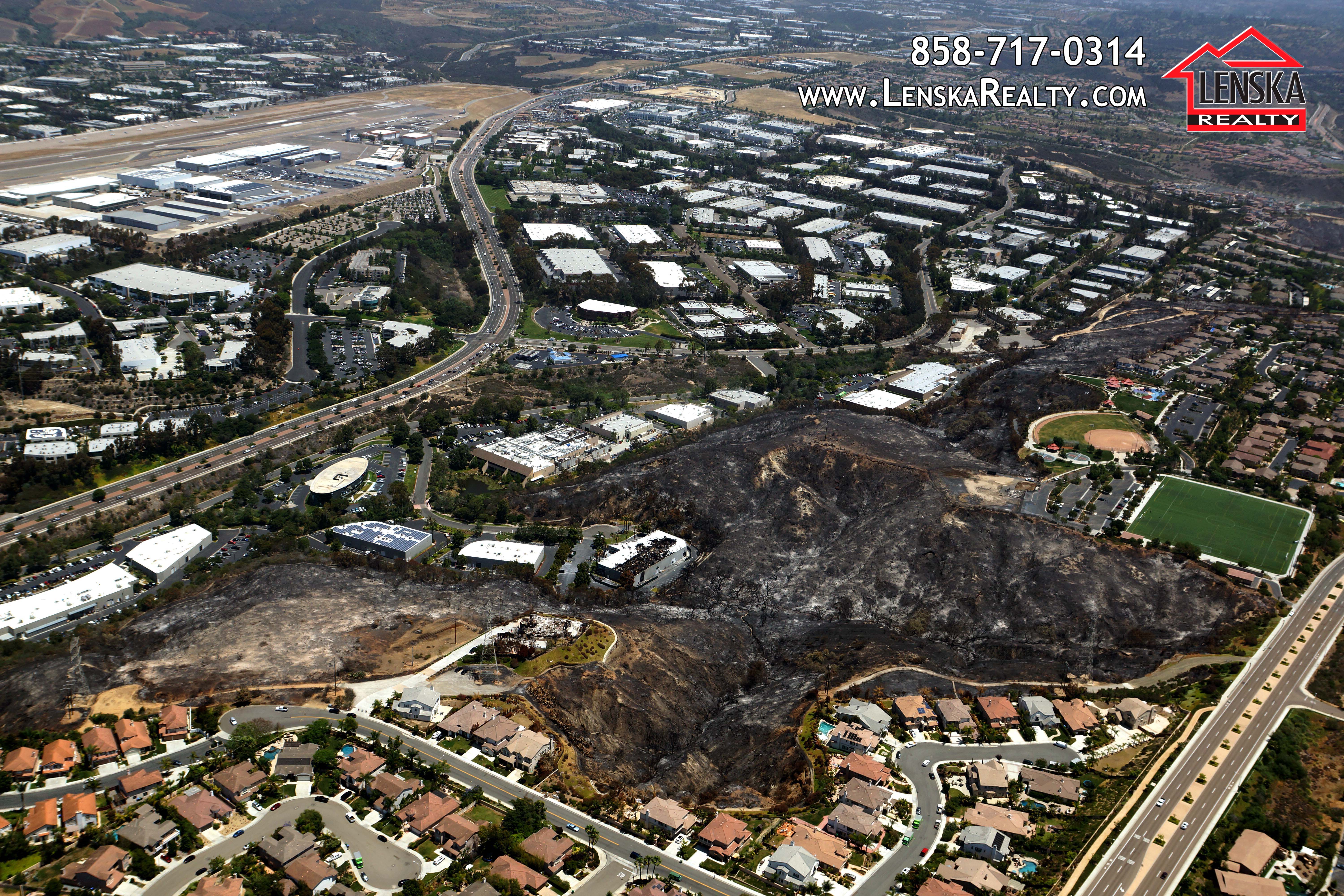
The next photo shows a view to the east with Palomar Airport in the top left corner. Look in the middle on the bottom of the photo and you see the fire damaged industrial building on Paseo Del Lago. Close by there are the two burned homes on Black Rail Road.
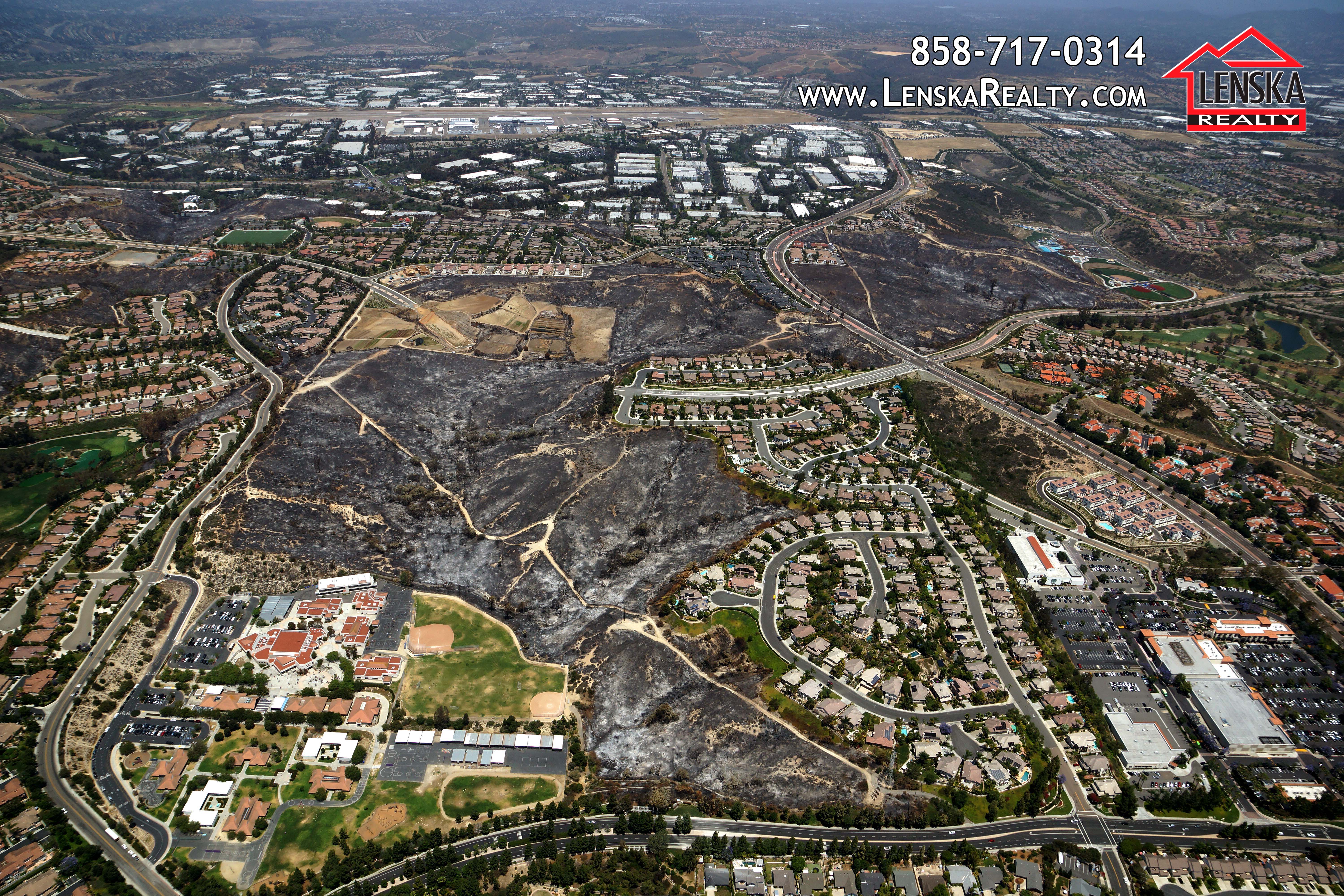
Another aerial view of the Aviara neighborhood shows how close the fire got to the Aviara Oaks Elementary School.
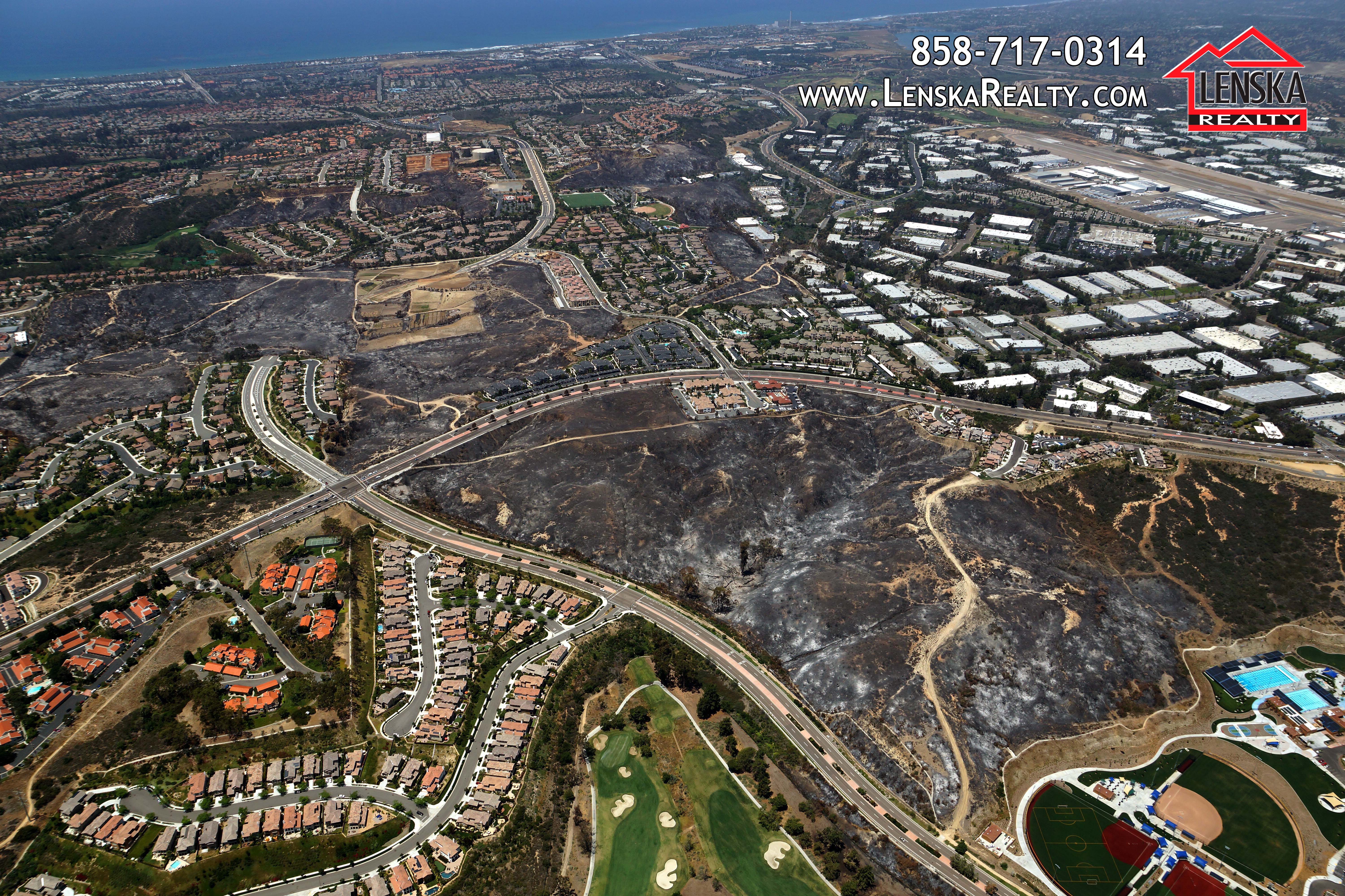
This image shows the brand new park the City of Carlsbad just completed and where the fire started before it jumped El Camino Real (road that is running from left to right ) and was fueled by Santa Ana winds to burn more than 400 acres.
Please email me at LenskaB@gmail.com if you would like to get other images of the Poinsettia fire.
Also, contact me if you need any custom aerial photography done of your home, business or property. Aerial images are a great tool to market oceanfront estates and luxury homes, because they provide overall view not possible from the ground level, shows the location advantages, access routes, neighboring developments, etc.
The aerial photography service is currently available in San Diego and Los Angeles counties.